Wednesday, July 27, 2011

Crapaud Man builds replica of 1800's Flour Mill

The following article appeared in today's Guardian Newspaper and copied here with a link to their website: http://www.theguardian.pe.ca/News/Local/2011-07-26/article-2675522/And-the-wheel-goes-round-and-round/1
Gordon Sherren, of Crapaud, proudly shows his handcrafted replica of a late 1800s stone flour mill, which will be on display in the South Shore Actiplex at the Crapaud Exhibition this weekend. The miniature mill can run just like a full-sized counterpart, with an overshot water wheel powering the structure’s many small cogs and pulleys.

Published on July 26, 2011
CRAPAUD — Gordon Sherren had a firm picture in his mind of what he wanted to build since 1987, although the vision started much earlier.
A trip to an old flour mill in Scotland during the late 1980s was but one of many times the 70-year-old had drawn inspiration from the structures, which were once the primary way of grinding grain on P.E.I.
 While the once-bountiful mills are rare today, after a year of tedious work and careful attention to detail, there’s now a new one running in Crapaud.
Well, sort of.
A scaled-down replica of a stone grist mill, which is about seven-feet high, will be on display at the Crapaud Exhibition this Friday and Saturday.
The replica, which is powered by a mix of electricity and an overshot water wheel, will be featured in the south side of the actiplex and is a fitting piece for the exhibition, which has a heavy focus on Island agriculture and heritage.
But having the mill on display was the last thing on Sherren’s mind when the enthusiast went out to begin the project last summer.
“I’ve been overwhelmed by the amount of interest people have had in this,” said Sherren. “It just started out as a project for myself, something to build.”
While Sherren only found time to begin his project after moving back home to P.E.I. from Ontario three years ago, his interest in mills are deep-rooted and steadfast.
Sherren has “always been fascinated by water,” and is able to remember walking down to the old mill on the outskirts of Crapaud, with his father in the 1940s and 1950s.
The interest continued through Sherren’s whole life, with full-sized authentic mill scales laying only a few feet away from his handmade five-inch replicas, in the barn where he built his new structure.
While Sherren has seen many mills throughout his life, visiting some old flour and grist mill museums and obtaining records and graphs from the Charlottetown Library served well for researching proper terminology and discovering how to make the replica run just like a full-sized structure.
“I just needed some information and specifics,” said Sherren.
Sherren said his brother, Robert, was one of his biggest supporters during the 1,000 plus hours it took to build the model and went to the barn every week to see his progress.
Robert has watched Sherren build many projects, but said his brother outdid himself with this one.
“It’s amazing what he was doing, the fine technical skills,” said Robert. “He must have had patience galore.”
Robert also pointed out that his brother had built the structure without having any blueprints to go by, instead relying on visits to museums and his own research.
“He certainly was able to have a vision of what he was doing,” said Robert.
Sherren said he isn’t sure what will ultimately happen to the structure, but he has other models, one of a mussel mud digger and another of a horse capstan, featured at the Orwell Corner Historic Village Museum.
While talks of a new provincial museum have perked Sherren’s interest, he said he won’t be rushing ahead of himself to find a new home for the mill.
“I’m not going to commit to anything yet, but I’m open to suggestions of where it should be.”

Wednesday, July 20, 2011

Schoolhouse in Roseneath

I was out to Georgetown yesterday afternoon to see Holy Trinity Anglican - on my way out I photograph this lonesome old schoolhouse on the Georgetown Road (Rte. 3) in Roseneath.


Simpson Mills Barn

I was out to the North Shore yesterday and out to the Simpson Mill Road in Hope River.  There's many of the Simpson family in the area.  To the right is an old Simpson farmstead.  To the left, behind the trees were and millpond.  Meachams 1880 Atlas shows two mills here, a Carding Mill and a Flour Mill - they're both gone now.
Below: Meacham's 1880 Atlas - Page 60
Below: The barn is classic - built into the side of a hill.  Often the livestock were in the lowest level (the view below is south facing) and on the other side the farmer could drive his hay waggon in to loft to unload hs hay, etc.
Below:  The exposed sandstone foundation adds great interest to the look of this barn.
Below:  The view from a north easterly view.
Below:  A close-up of the roof vents - theses were placed to take excess heat from the loft - there are three on this barn.
Below:  The East view.

Monday, July 18, 2011

Wild Bears in Alma

My great-great-grandfather Stephen E. Jeffery of the Centerline Rd. Alma, had a few bear encounters in his lifetime.  Stephen was one of the earlier settlers to the Centerline Road area. Below is an illustration I drew interpreting the early look of the homestead.

Below:  An article which appeared in the Alberton Pioneer on March 7, 1877.
      On Monday the 5th while Mr. Stephen Jeffery of Lot Three was in the woods his dog discovered a bear which had taken up its winter quarters under the roots of a large tree that had blown down.  Mr. Jeffery having cleared away the roots and bush found a she bear with 2 cubs.  The two cubs were then taken by Mr. Jeffery to be raised by him.

Below: Photo of Stephen E. Jeffery (1830-1911) and his 3rd wife Jane Collicutt - photo taken around 1900.
 
Below:  An article which appeared in the Summerside Journal-Pioneer, c.1967

LETTER TO THE EDITOR: WILD BEARS
Sir:
   Some time ago, Mr. F.H. Mac-Arthur in an article in your paper, wrote about wild bears on Prince Edward Island and suggested it might be interesting to know when the last wild bear was killed in this province.
   It is not my intention to attempt to supply that information but I do think that the following might be of interest.  The subject of this is one Stephen Jeffery, who was one of the first settlers in the Alma, Lot 3 area.  He shot and killed a wild bear in the woods, at or near the dividing line between Lots 2 and 3, now known as Alma and St. Louis area.  Mr. Jeffery saved the hide of this bear and it was shown to me by one of the Jeffery family, sometime around the turn of the century. 
   I have reason to believe that that bear’s hide is still there as the property has been in possession of the Jeffery family ever since and the present family living there is raising the fifth generation of the Jeffery’s in this case. 
   I have no idea how many wild bears might have been killed since Mr. Jeffery killed this one, but I do think that a wild bear, skinned would be a rare thing to find anywhere in this province.  The above-mentioned bear must have been killed in the last century.
W.B. McLellan, Alma, PEI

Below:  The Stephen E. Jeffery Homestead as it appears today.

Farmhouse Rental in the News

     The owner of this establishment was on CBC Radio this morning talking about their rental property and the updated PEI rreservation system and somehow their property booking rate was listed as 2x the regular rate - as a result they've had no bookings until last week - missing out on the first half of the tourism season.  They are located on the West River in Fairview (near Cornwall) PEI.
     It's great that some of these old Island Homes have been converted to rental properties - it gives visitors a taste of our architectural and cultural heritage.

       The information  below comes from their websites: 
http://www.princeedwardisland-canada.com/westriverinn/

     The property is ideal for  vacationing.  The fifty acres  consist of wooded trails and open meadows and  approximately  one half mile of  beach front on an inlet of the West River.  This is tidal  with salt water but being on the south side of the Island there is no danger of  ocean currents or rip tides.  It is sandy and very warm for swimming.  The West River empties into the Northumberland Strait. There is also good clam digging along our beach.   There are  other sandy beaches and picnic grounds on the ocean as well as 2 provincial parks within a five to ten minute drive.
The Farm House
 
     The farmhouse was built in the l850’s and has been renovated completely.  It is a two storey white Island farmhouse with a red roof.  There are three bedrooms on the upper level, one large master bedroom and two smaller bedrooms.  There is a large bathroom on this level with a whirlpool tub/shower and washer and dryer.  The main floor consists of a large living room,  kitchen and dining room plus a powder room. The property features large lawns and gardens and a deck with a propane barbecue for your entertainment.

Friday, July 15, 2011

The Old Barn Book

This book was written by Robin Langley Sommer.  Published 1997 by Saraband Inc., CT and Prospero Books (a division of Chapters).  ISBN 1-887354-11-5.  There are three pages in this book featuring Prince Edward Island barn - including the Orr homestead on the Snowie Road as well as barns from Souris, Wheatley River, Burlington and Springbrook.
Old Barn Book
This book is part of a series of books that include, The Old House Book; The Old Church Book; The Old Railway Station Book - all have Prince Edward Island buildings featured amoung many from all over North America.

Great Barns!!

This homestead is on Route 13 in Hartsville.  The barns are in pretty good shape for old barns and seem to have a sound structure.  The house is center gable style with small kitchen wing - circa 1860s-70s.
Barns were often situated to create a barnyard protected from the winds - these barns are positioned to protect from the northwest winds - the barnyard in the view below is south-easterly facing towards the road.
These barns have a classic arrangement of doors and windows - each door would lead into a different area of the barn, ie. the horse stable, the cow stable, etc.
Below:  The gable end of the smaller barn - note the large hay loading door which has been boarded in, now with a small window and door.  Also note the hay-fork rail extending out the top of the hatch.
Below is an image of a type of hayfork that might have been used in this barn.  It was equipped with pulleys and ropes running on a rail high in the barn loft.  The fork would take the loose hay from the hay wagon up into the loft, loosely stacking it.
Image c.f. Googles Images

Thursday, July 14, 2011

Trip to the South Shore area...

I was down to the south shore area today for meetings.  Here's a few photos.
Above:  The former Hampton United Church located on the Trans-Canada Highway (Rte.1.) in Hampton, P.E.I.  The church has been renovated and painted - now used as a dental office.  Back in February 2011 CBC's Maritime Noon program had a phone-in show on the topic of what to do with our old, decommissioned churches?  The owner of this church, Dr. Peter Bevan-Baker, was one of the guests on answering questions, etc.  I took meticulous notes and someday hope to do a presentation on the topic along with information gathered from a symposium in Halifax I attended in April 2010.  The symposium was on "The Conservation of Religious Buildings and their Settings" - it was held at the Atlantic School of Theology and sponsored by the Heritage Trust of Nova Scotia.  It was a full day of speakers on a variety of topics - one things that was stressed was that poor restoration methods will eventually be the demise of any heritage building.  They held another symposium in April 2011 but we were unable to attend- check out their website:  http://www.htns.ca/
Above:  A little further up the road is the former Flood Homestead.  This is located in South Melville on the corner of the South Melville Road (Rte. 246) and the Sandy Point Road.  Back years ago this farm often appeared in Island tourism literature.  It's not far from Mac Dixon's Grist Mill (featured on June 8th in this blog).  Back in the early 1990's we visited here often as we made our way to Victoria-by-the-Sea.  The farm was sold out of the family about 15 years ago.
It was typical practice to build a new barn onto/over the old barns - my father did the same to his old barn.
Below:  Just across the road from the Floods on the South Melville Road is this old schoolhouse.  For many, many years it was abandoned and surely to fall in to the ground but in recent years someone has restored/renovated the school complete with the sign.  Excellent!!!
Below.  I went further on to see clients along the Desable Road (Rte.19) and spotted this house.  Hum, I would have done a few things different in renovating this house - ie. no house looks good with basement windows on the front; it has new vinyl siding and all the windows have been changed to casement - the casement windows here don't take away from the look as these are very wide for casements - often they're narrower.  It's an interesting style in that the front has two equal gables.  It's age? maybe 1870's.
The Desable-Argyle Shore area of the Island was settled by Scottish immigrants from the Isles in the 1820's.  I visited a client today about a new house to be built along Rte.19, the shore road.  Following we got talking about the area and I told him that my grandmother's family, the MacNevin's, were amoung the earlier settlers here and that in the 1880's my great-great-grandfather Neil "Tidy" MacNevin moved to the Brae (near O'Leary, PEI) with his family.  He said that his great-great-grandfather bought Neil's 33-acres over there, adjacent to his farm.  Wow!!!  I never knew where that farm was.  He said his family has been in the area since the 1820's and likely came over with the MacNevins - his family was from the Isle of Colonsay - mine were from the Isles of Mull and Coll. 
Above:  a few miles west up the road in Canoe Cove, where Rte. 19 turns to Rte.19A (Canoe Cove Road), is the Canoe Cove School, Est.1820.  I believe there's been a school here since 1820 but this school dates back to about 1850.  Below is a painting by Robert Harris, titled "School House at Canoe Cove".  Robert's sister married into the Stretch family and lived in the area.  The Painting cf. Historic Places website - for more information see http://www.historicplaces.ca/en/rep-reg/place-lieu.aspx?id=1773
School House at Canoe Cove - 1880
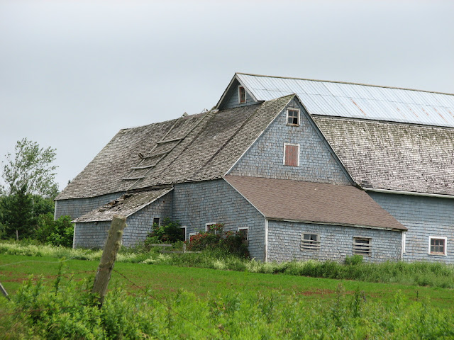
Above:  On my way back to Hunter River, I photographed this barn on the Colville Road (Rte. 9)  As they'd say - nice old barn!

Sunday, July 10, 2011

My brother collects and sells Architectural elements...

Here's a few things I photographed in my father's barn - my brother travels all over the Island and salvages these items from soon-to-be torn-down houses.  He stores them in the loft of Dad's old barn.
 Below:  A door from the Strathgartney Homestead in Strathgartney, PEI.
He has more than 250 old doors - every style and shape!
 Below:  An interior door from the Redmond-Matthews House, Main Street, Alberton.
 

Dunbar House, Montrose - 2nd update

I was uphome (Alma, PEI) this past weekend and saw the banister and two doors from the recently torn-down Dunbar House in Montrose, PEI.

Wednesday, July 6, 2011

Stewart Memorial Park, Cavendish

This is a replica of the North Rustico lighthouse in the public park between Shining Waters Fun Park and their parking lot.  I didn't do the drawings for this building.  Arnold Smith and I researched and designed the 6 display panels inside the lighthouse - they tell the history of the area and our Island.
 The lighthouse is about 1/3 scale of the original.
 Below:  Looking up into the lighthouse - there's just the main floor and no other floors.
 Below: I photographed the six panels to illustrate our work herein.