Showing posts with label PEI Barns. Show all posts

Friday, February 20, 2015

Over 100 barns blow down in 1930 Winter Storm

     The following comes from, 150 Years of Prince Edward Island Weather: Some weather we're having! 2015 PEI Weather Trivia Calendar by Don Jardine and Adam French with David Weale, and the Climate Research Lab at the University of Prince Edward Island.
     February 16, 1930: "A terrific gale, reported as the worst hitting this area in many years, blew down over 100 barns in Kings County.  Winds hit a maximum of 65 km/h at Charlottetown and 37 cm of snow fell.  Two young sons of Mr. and Mrs. Edward Noade of Launching Place narrowly escaped death when they were feeding cattle in the barn and the barn collapsed.  Large pieces of the barn roof were found on Boughton Bay and shingles were found on Boughton Island, three kilometers away."  
* * * * * * * * * * * * * * * * * * * *
     It's always nice to have an image with a story - since we don't have one from 1930, here's an old barn at the Stetson's on the O'Leary Rd. in Union (between O'Leary Corner and O'Leary) destroyed by a wind storm in the fall of 2009.

Saturday, July 26, 2014

Old Barn, Hope River - demolished

     On July 3rd I noticed the windows had been taken out of this old barn and thought it must be in advance of demolition - so I took these photos.  It's located on the St. Mary's Road (Rte 224) near the intersection with Simpson Mill Road.
     Meacham's 1880 Atlas of Prince Edward Island shows this farmstead was 2 farms, to the right/west was Felix Murphy with 55-acres and the Hope River Post Office.  The farm to the left/east belonged to Jno Hogan with 60-acres. 
     Cumin's 1928 Atlas of Prince Edward Island shows the two farms above now one farm owned by Leo Reid with 114-acres.  
     Above is the new house that belongs to this farmstead - the old barn is to the left.  This house was built in 2003-2004 - it replaced the house below which was moved over to the east corner lot (at St. Mary's Rd and Broadway Rd.) of the farmstead, restored and sold.
     The photo below was taken on Feb. 14, 2004 - it shows the original house (now the yellow house above) with the new house behind (beige house /w red roof above) and the demolished barn above, in the far left.
On July 14th I took the photos below of the barn demolished.

Friday, May 16, 2014

Keefe Farm, Est.1835, Kinkora

     The Keefe Farm is located on Rte. 225 beside the Confederation Trail in the rural community of Kinkora.  Parts of the house date back to the mid-1800's
The barn was built in 1964.

Wednesday, April 30, 2014

Old Barn, Huntley

     This old barn will soon be gone - like so many old barns in rural Prince Edward Island.  
     This farm belonged to Will Horne who likely built the barn sometime in the 1930's.  The farm was bought by Ross & Jean Brennan in the early 1970's - they lived here for near a decade.  The property has changed hands a few times over the years.  The barn has been used for storage for near 25 years.
     My father, Wilbert Jeffery, worked here as a young man in the 1940's and 50's - he recalls this barn always being here.
     Will Horne married Mary Gordon, daughter of John Owen and Grace (Riley) Gordon, of the Western Road in Alma.  
     Meacham's 1880 Atlas of Prince Edward Island show this farm belonging to a large section of land (240 acres) of the Estate of Rob't Gordon.  
     Cumin's 1928 Atlas of Prince Edward Island shows William Horne owning 75 acres here.
     Above: the barn north side of the barn which is located on the south side of the Cheese Factory Road in Huntley.  The Cheese Factory Road connects Huntley to Alma. 
      Above/Below:  The northeast corner of the barn.  The metal siding and roofing is being removed in preparation for demolition.

Tuesday, April 15, 2014

Taylor Road, Wilmot Valley

   I was in Summerside the other day - instead of taking the Blue Shank Road home I went to the other side of the Wilmot River and took the Taylor Road.  Here's a few photos of some interesting old places on that road...
     The house below is on the west end of the Taylor Road, bordering on the Wilmot River.  The images below are the front / south facing side of the house.
     This house has beautiful detailing of trim and eave bracketing.  The front features a projecting dormer with entry below and two square bay windows.  A kitchen wing with west facing verandah is to the rear/north of the house.
      The large two storey house below is up the road eastward from the house above.  You can see the Wilmot River behind the house - the white house is across the river on the Blue Shank Road.
Below: Valley View Farm
     The farm is located on the south side of Taylor Road, closer to the end towards MacMurdo Road.
Here's some other views of the property - great old buildings!

Wednesday, April 2, 2014

Arsenault Barns, Abram-Village

     This farm is located off Route 11 in Abram-Village.  Georges Arsenault took these photos in 2007 and supplied the following information.  Thanks Georges!
     "These well kept barns are located in Abram-Village.  Leo S. Arsenault and his sons, Gilles and Jean-Guy, are the last farmers in Abram-Village.  
     The barn in the first picture (above) belonged to Aubin J.N. Gallant who lived about half a mile from Leo's place. In 1964, Leo and his father Sylvère bought the barn and had it hauled on their property. According to Adrus, Aubin's son, the beams were squared by hand. Leo tells me that it looks a bit younger than their old barn. So maybe it dates from around 1900.
      In the other photo (below), the first building is the granary and the older part of the big barn would date back to circa 1870."
"Here is an aerial photo below of the farm circa 1970."
Ferme Sylvère Arsenault, v. 1970

Old Barn at Bloomfield Corner

     I photographed this old barn in May 10, 2008.  It belongs to the Horne Family and located on the north side of the O'Halloran Road ( Rte. 145 ) near Bloomfield Corner and not far from the clay country road, Botts Road.  
     This property has been in the Horn(e) family since before 1880.  Meacham's 1880 Atlas of PEI shows R.H. Horn with 200 acres here; and Cumin's 1928 Atlas of PEI shows Robert Horn here with 200 acres.
     Sorry for the poor photograph.
     I was by here last Saturday and surprised how fast the building has become ruins.

Wednesday, December 4, 2013

Barn on Munn's Road

     I was also up to Kingsboro yesterday as I traveled around eastern Prince Edward Island. Just opposite Eastern Kings Community Center, on Munn's Road, is this old barn - probably not long for this world!  So many of these old barns are falling out of use by farmers these days.

Thursday, November 21, 2013

Chelton Saltbox House

     This is the last posting from my tour around the Chelton and Fernwood area.  
     This very old house at 48 McCardle Road caught my eye!  It would date to the mid 1800's - seemingly a saltbox style house with a center dormer on the east front.  The kitchen wing off the west would likely have been added later.  Not many saltbox houses remain on the Island - today a few remain can be found in Charlottetown's old downtown. 
     The three photos below were taken from the Campbell Road, the next road up, paralell to the McCardle Road.  
     Sorry, the photos are a bit blurry!   That's the Confederation Bridge in the background.
     The following four photos were taken from McCardle Road.  Also, there's an old barn/shed (possibly an old house from the size of the windows) to the rear of the property.
     This house is For Sale through Century 21.  The old house has had many "not so sympathetic" updates including new windows and vinyl siding.  
     The real estate listing describes the house as  “Spacious century old farm with a million dollar view...great multi-family home...”   It also notes the house having 5 bedrooms in 2,500 sq.ft. on a 1-acre lot.  
     Here’s the link to Century 21  http://www.century21pei.com/details.php?id=13068085&c=1
     The following photos are from the real estate listing.
* * * * * * * * * * *
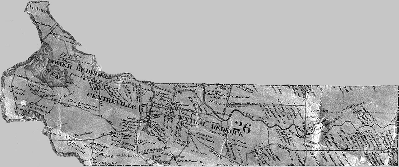
      The 1863 Lake Map (below cf. http://www.islandregister.com/lakem/lots/lot26.jpg) shows P. Callbeck at this location with Wm. Wright as a neighbour ( this is possibly P. Callbeck, president of Legislative Council in 1774, 1786, /  Philipps Callbeck, Attorney General 1770 cf. http://www.islandregister.com/meachamexerpts.html ).
 Below:  close-up look.
     According to Meachams 1880 Atlas of Prince Edward Island, this property belonged to Wm. Lowther with 39 acres and 23.5 acres across the road along with two other parcels of 25 and 78 acres, northward up the Chelton Road.  
     In Cumin’s 1928 Atlas of Prince Edward Island shows Fred Murphy owning this property.