Showing posts with label Demolished. Show all posts

Sunday, March 29, 2020

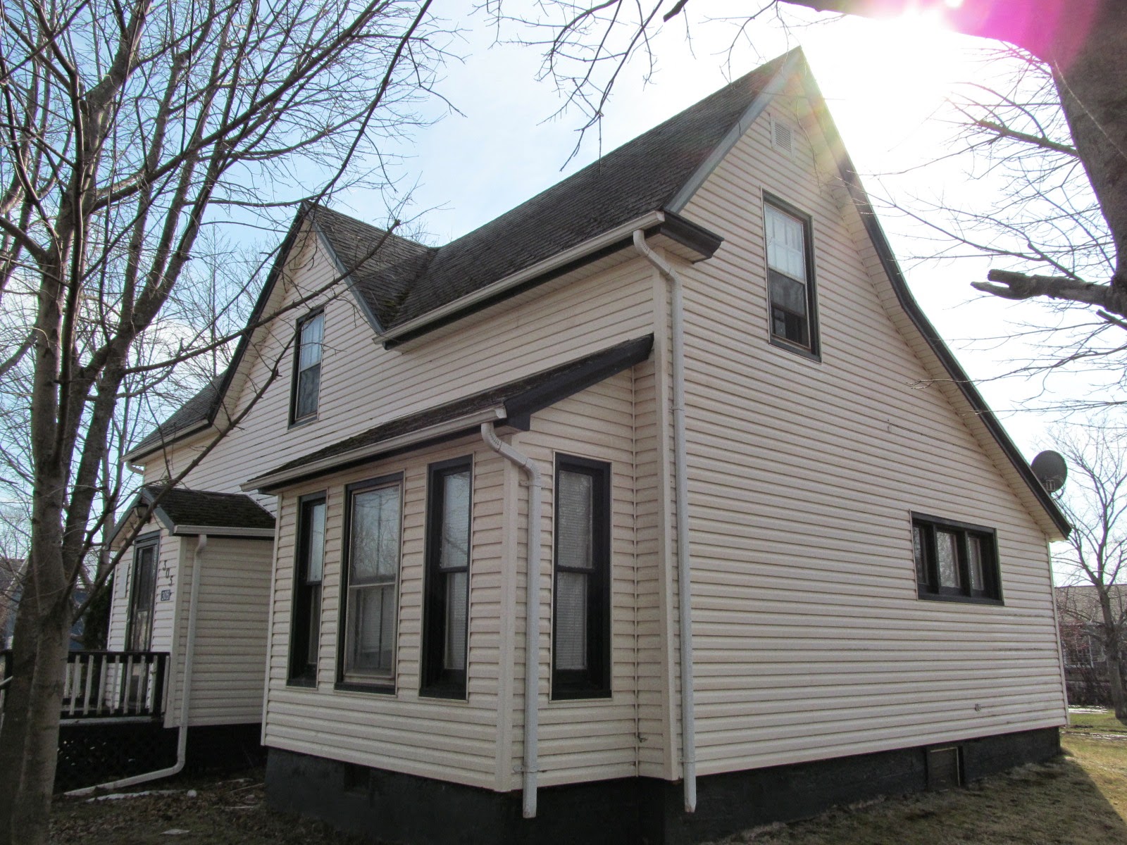
Spring Park House, Charlottetown - demolished 1996

     I was sorting through some papers recently and found this article which appeared in The Guardian Weekend newspaper in the spring of 1996, later that year the historic Spring Park House was demolished.


Developers vs. history buffs: City heritage advocates concerned that history Spring Park house could be torn down for apartment units
The Guardian Weekend. Saturday, March 23, 1996
By Ron Ryder
The owners of a history Charlottetown building are considering tearing it down and rebuilding, which has a well-known city heritage advocate in an uproar.
Catherine Hennessey, currently visiting Boston, Mass., was so worried about the fate of the home once called Spring Park that she phoned home to rally people behind the building.
Looking at the grew building that houses 8 and 10 Duvar Court, nobody would guess it was once the manor house of a country estate. Decorated with peeling paint, a sagging extension and garbage in the front yard, the house that gave its name to an entire neighbourhood now looks like a textbook case of renovations gone wrong.
But Spring Park has a history that belies its appearance. In fact, the home is believed to be the birthplace of John Hamilton Gray, a former premier of P.E.I. and one of the Fathers of Confederation.
Hennessey says developers want to tear the home down and erect an eight-unit apartment building in its place. She’s crying foul.
The former city heritage committee chair says the building has been let go and hasn’t attracted public attention because it’s on a side street and hasn’t been designated as a heritage site.
Those factors reduce the ability of history buffs to protect it, she added.
“This building is not listed. That’s the problem.”
According to local developers Hennessey’s panic is premature.
Before the building can be torn down, developers will have to get a permit from Charlottetown City Council. And the city’s planner says it shouldn’t even go to council before May.
The proposed new building is one of two multi-unit residences developers want to build on Duvar Court and on an adjoining lot at 122 Spring Park Road.
Brooke MacMillan, one of three partners behind the proposed development says they haven’t definitely ruled out saving Spring Park.
“We’re going to try to do what’s best for everyone in terms of heritage interests and business interests and hopefully we can find a happy medium,” he says.
He said people who want to preserve the old building ought to provide some incentive.
“If the building costs more to save than it does of us to tear it down and put up another one, then so be it. Unless someone’s going to pay the difference,” MacMillan says.
The project plans are far from finalized, he says.
“It’s a long road ahead of us,” MacMillan says. “There’s no bulldozers going in tomorrow.”
Ed MacDonald, curator of history at the P.E.I. Museum and Heritage Foundation, says Spring Park was originally granted to Robert Gray, John Hamilton Gray’s father, by the lieutenant-governor of P.E.I.
He says the state was part of an area known as the common on the outskirts of the city. It included extensive pasture land, orchards, a brook and gardens that were famous in the city as a place to picnic.
“Local Charlottetonians used to be able to avail themselves of the gardens at Spring Park,” MacDonald says.
He says the plain, sturdy original building has been undermined over the years.
“That has been much added on to over the years, a lot of the renovations haven’t been (architecturally) sympathetic,” MacDonald says.
The building is one of the oldest in Charlottetown and would add to the architectural history of the city, he says.
Christopher Severance, executive director of the P.E.I. Museum and Heritage Foundation says the loss of a historic building means the end of a concrete tie to the past along with part of the city’s character.
“The whole heritage of the Island, once you lose something like that, is poorer as a result,” he says.
Coun. Mitchell Tweel, chair of the city’s arts, heritage and culture committee, says the idea of a new apartment building on Duvar Court came up last year but was put off because area residents didn’t like the idea of a new complex.
He said the new proposal hasn’t even come up for discussion with his committee yet.
“As far as the Heritage Review Board goes, nothing has come forward,” Tweel said.
Tweel added the board is working on proposals for ways to promote heritage preservation in Charlottetown. HE says the city should look at options such as tax breaks to encourage people to maintain important pieces of real estate.
But he says heritage activists seem to be set on blaming developers rather than encouraging them.
“They always been in this confrontational mode,” Tweel said.
Hennessey says the money spent demolishing the old structure and putting up a new one should be put toward refurbishing Spring Park.
“If they could experience the satisfaction of saving an old building they’d see how wonderful it is,” she says. “We’ve been through that building it’s structural fine. It looks like hell.”

ABOUT ROBERT GRAY...
Robert Gray, came to Prince Edward Island in 1787 as private secretary to Governor Edmund Fanning. Both men came to British North America as Loyalist refugees in the wake of the American Revolution. Robert Gray married Mary Burns, daughter of George Burns, a prominent merchant and Island landlord. Gray was sent to England for his education, and spent his 20s and 30s in the British military, including service in South Africa and India. He retired with the rank of captain in the 7th Dragoon Guards. While still in the military, he married Susan Bartley Pennefather, step-daughter of J.L. Pennefather, an officer in the 7th Dragoon Guards. Gray named his first child Harriet Worrell Gray, in honour of the sister of Charles Worrell, a resident Island landlord who at one time owned close to 100,000 acres, including some once held by George Burns. The marriage of Gray’s sister, Jane, to Artemas Cambridge further strengthened Gray’s ties with leading entrepreneurs and officials who moved back and forth between Britain and Prince Edward Island. When Gray returned to Prince Edward Island in the 1850s, he was appointed to the Legislative Council, the upper house in the Island Legislature. Gray rejoined the military during the Crimean War, but did not see active service. 

**To see a map of “Spring Park” refer to the Public Archives of PEI
http://www.gov.pe.ca/parosearch/archives/individual-archive-search/path/ajax.individual.phtml/recordId/50808
Map0642 
Host Collection
Public Archives and Records Office map collection 
Physical Location
Public Archives and Records Office of Prince Edward Island 
Caption
A plan of Spring Park, the property of Robert Gray  
Date (original)
[ca. 1828] 
Creator (original)
Unknown 
Description
A plan of Spring Park, Charlottetown, Prince Edward Island, the property of Robert Gray. Key shows a breakdown of the condition of the land. Total acreage: 76. Also shows sketch (lithograph) of dwelling house.  
Subjects
BUILDINGS
COMMUNITIES

Restrictions
PERMISSION FOR USE OTHER THAN FOR RESEARCH PURPOSES IS REQUIRED FROM THE PUBLIC ARCHIVES AND RECORDS OFFICE; QUESTIONS REGARDING COPYRIGHT ARE THE RESPONSIBILITY OF THE USER 

Sunday, February 5, 2017

Haszard-Cannon-Montgomery-Adams-MacDonald House, St. Eleanor's - Demolished

     I received this note today from Summerside resident Roxanne Hately-Leard.  Much thanks for bringing this to my attention and for providing additional information!    
     "John E. MacDonald House... I took this picture a week ago Friday.  to my dismay, it was torn down this past Monday.  It had been condemned.  It was also known as the Loman Adams house.  This was an old house.  I think it had been moved from North Street, St. Eleanor's.  It sat across the street from St. John's Anglican cemetery.  Thought you would be interested in this.  Enjoy your blog.  I think many more will after the article in the news." 
     The house was located at 45 South Drive in St. Eleanors.
      The following information about this house comes from Sketches Of Old St. Eleanors. 1973. Page 30
      “Thomas C. Cannon, son of Fred and Mary Lane Cannon set up business on the corner dealing in oysters which at one time sold for $5.00 per barrel.  He also sold flour and other goods.  His residence was erected by Haszard previous to 1856.  An oyster house was located on the opposite corner (Bernards).  The house was sold to R. H. Montgomery and in 1917 to Loman Adams who moved from Birch Hill to St. Eleanor’s in 1913.  The house was moved later as the corner lot was suggested as a suitable location for the Soldier’s Monument.  This house is now the residence of John MacDonald, the exterior architecture has remained much the same as the original.” 
     This is amazing - unknowing I'm related to this property through the Cannon and Compton families.  Here's some Cannon genealogy from www.islandregister.com
* * * * * * * * * * * * *
Thomas Compton Cannon b. May 10 1836, St. Eleanors, PEI., m. Nov 23 1863, Amy Ellen Craswell, b. ___ 1842, d. Sep 20 1877.  Thomas died Dec 09 1887, St. Eleanors, PEI.
Children:
i   Gertrude Cannon m. John Porter.
ii  Minnie Cannon m. Stanley Compton.
iii Maude Cannon m. R. H. Montgomery.
iv  Bertha Cannon m. John Creswell.
v   Fanny Cannon.
vi  Arthur Cannon m. Elizabeth Cameron.
* * * * * * * * * * * * *
     Here's more information about R.H. Montgomery from Prince Edward Island Family Trees  http://www.janedyment.ca/ppl/e/c/ce7808543961d04b5cd5134f6ce.html
R. H. Montgomery
Age 66; 
Residence Summerside; 
Born Porthill.  Father Donald Montgomery. Mother Christie Woodside; 
Date of Death 19 March 1929; 
Entry Number 288
Source RG19/s2/ss6: Death registration books, 1929
Marriage
Groom's Name Robert Hodgson Montgomery; 
Groom's Residence Summerside; 
Groom's Status Bachelor; 
Bride's Name Amy Maude Cannon; 
Bride's Residence St. Eleanors; 
Bride's Status Spinster; 
Date of Marriage License or Bond 15 August 1898; 
Date of Marriage Ceremony 17 August 1898; 
Officiant's Name John M Withycombe; 
Source RG19, Series3, Subseries4: Marriage Licenses, 1898

* * * * * * * * * * * *
    I keep finding more information...this house is in the 1880 Meachams Atlas plan and in elevation.
Below is St. Eleanor's Corner from the 1863 Lake Map.

Tuesday, December 6, 2016

62 Victoria St., Kensington - Demolished!

     Today was a good news / bad news day!  I had to run up to Kensington late this afternoon and to my horror this lovely house on Victoria Street had been demolished and the hole was being filled in with fresh shale.  I expect it was demolished to make way for the adjacent service station!  Too bad!!
     Here's a photo from Google Streetview...
Here's the aftermath photos!
     For more information about this house and others in Kensington, see the following:

Heritage Homes History, Property Ownership, Kensington

ISLAND NARRATIVES PROGRAM
Kensington, PEI Heritage Homes History of Property Ownership
KenNet Research Team Winter 2011 
This report contains over 250 ownership profiles of Kensington,
Prince Edward Island’s historic homes. 
Kensington Seniors Surfers Computer Club ©2011

Thursday, October 8, 2015

Robert Gallant's Blacksmith Shop, Howlan - Demolished

     On my way to O'Leary the other day, I took the route through Howlan - below is what remains of Robert Gallant's Blacksmith Shop.  Another historic building gone!!
     I guess the old buildings were in too bad of shape to be moved.  Sorry to see this rural landmark gone!
See previous post on this blog dated June 12, 2011...
Below is an image of Robert Gallant, taken by Lionel Stevenson in 1985 - the photograph was published to in the book, Elders of the Island by Mary O'Brien, Lionel Stevenson, Terry Dunton Stevenson.  UPEI and Ragweed Press.  ISBN 0-920304-53-2.

Friday, February 20, 2015

All Saints Parish, Cardigan

     Here’s the last of the photographs I took last week in Cardigan - All Saints Parish Church on Chapel Road near the intersection with Launching Road.
     The following information comes from, A Faith Walk: Diocese of Charlottetown. 2001.  By Reverend Art O’Shea.  Page 49.
     “In the early 1800’s a few Scottish immigrant families settled this area and eventually other Scottish and some Irish families joined them.  In 1874 they built the present beautiful church which they dedicated to All Saints.  Of French Gothic design, one of its special features was the main altar of Italian marble constructed by parishioner William Lewis.
     The rectory is undated but is said to have been moved to its present site before 1900 after which two towers were added.  Father John MacMillan was the first resident pastor and served from 1894 until 1916.  One of his magnificent accomplishments while in Cardigan was his writing of a two-volume history of the Catholic Church in Prince Edward Island covering the years 1720  to 1891.
     J.J. Bowlen, Lieutenant Governor of Alberta in the 1950’s, was a native of Cardigan Parish.  His brother, Father William Bowlen, while pastor at High River, Alberta baptized former Prime Minister Joe Clark.
     In 9154 the parishioners constructed a Marian archway at the entrance of the church to commemorate that year’s well celebrated Marian Year throughout the world.
     In recent years the church has received extensive renovations including a splendid new basement with facilities for its parish functions.  One of its sections is named the “MacMillan Room” after the above-mentioned pastor and in which parish wakes are held.
     Named after on of the earls of Cardigan, the village area where the church is located offers a picturesque view, touched off by the beauty of its river of the same name which winds through the center of the parish. 
     Today there are 160 families in All Saints Parish.”
      The following information cf. Historic Places website...
     “Construction began in the Spring of 1874 and by November, the church was completed and blessed by Bishop McIntyre. It originally did not include the transept which was added later. The building retains many of its original style elements which include the segmented entrance tower with a spire rising from the middle of four triangular gables on each of the four sides of the tower. These are each topped by a small cross.  The large gable roof features eave bracketing and the transept features a Celtic style cross at the peak of each gable. A transom Gothic window is placed above the double entrance doors. Several renovations, the most recent in 1995, have been made to the building. The original sandstone foundation was replaced by a large modern basement which accommodates many church events. The interior features a rare Italian marble altar which was carved by one of the parishioners, William P. Lewis.”
     The interior photo below also comes from Historic Places website...
Showing view of interior
     Below is an image of All Saints Parish House.  cf. "Can you Identify these people" on the Island Register website.  The house was demolished in recent years.

"Hi Dave, It is the All Saint's Parish house in Cardigan, he said it was taken about 1970. Rev. David McTague would have been the parish priest at that time. Nora Macdonald" -  June 24, 2013

Thursday, October 2, 2014

Rolling Bank Cottage, Wilmot Valley - Demolished

     I nearly drove off the Blue Shank Road earlier this week when I looked towards the Taylor Road and saw this mid-1800's cross-gabled house reduced to a huge pile of debris!!!  
     I took these photos from roadside using my zoom lens - there were "No Trespassing" signs are posted.
Below are before photos I took on June 19, 2005.
See January 14, 2014 post on this blog...

Monday, August 18, 2014

Dundas Farm House demolished

     I was out to Spry Point last week and was surprised to see this house in Dundas gone - demolished!
See January 4, 2014 post about this house...


Saturday, July 26, 2014

Old Barn, Hope River - demolished

     On July 3rd I noticed the windows had been taken out of this old barn and thought it must be in advance of demolition - so I took these photos.  It's located on the St. Mary's Road (Rte 224) near the intersection with Simpson Mill Road.
     Meacham's 1880 Atlas of Prince Edward Island shows this farmstead was 2 farms, to the right/west was Felix Murphy with 55-acres and the Hope River Post Office.  The farm to the left/east belonged to Jno Hogan with 60-acres. 
     Cumin's 1928 Atlas of Prince Edward Island shows the two farms above now one farm owned by Leo Reid with 114-acres.  
     Above is the new house that belongs to this farmstead - the old barn is to the left.  This house was built in 2003-2004 - it replaced the house below which was moved over to the east corner lot (at St. Mary's Rd and Broadway Rd.) of the farmstead, restored and sold.
     The photo below was taken on Feb. 14, 2004 - it shows the original house (now the yellow house above) with the new house behind (beige house /w red roof above) and the demolished barn above, in the far left.
On July 14th I took the photos below of the barn demolished.

Monday, July 7, 2014

Murray River Train Station - Demolished today

     Lately my blog is becoming a register of demolished buildings!  Today the 110-year-old  Murray River Train Station was demolished.
The Murray River village council in eastern P.E.I. decided to tear down its old train station.
Photos cf. CBC PEI's website post today...
Murray River train station

Brown Sisters House, New Glasgow - Demolished

     One day last week we saw this house and lot, located on the northwest side of the bridge in New Glasgow, being cleared of the trees and brambles that have grown up over the past few years and wondered what was going on.  Well, a trip through New Glasgow yesterday told the story, it was demolished.
     Locally, this place was known as the Brown Sister's summer home - they lived in town and came out to New Glasgow for the summers.  Their 1.2 -acre property goes down to the water / Clyde River, across from New Glasgow Lobster Suppers.
     The house was sold sometime around 2009 but wasn't used much - it was for sale again recently.
The photo below was taken in March 2003
The Photo below was taken in May 2003
The photos below were taken in March 2007
The following photo was taken on February 18, 2012.

Thursday, July 3, 2014

Buote House, Tignish - Demolished

     I was in Tignish the other day and saw this old house has disappeared from the landscape of community.  It was located on Church Street (Rte. 160) between The Co-op and St. Simon St. Jude Catholic Church.
     This house was a prominent building in the community for alot of reasons including it was once a doctor's office.
     I had an opportunity to measure and photograph this house on March 22, 2012 for an anticipated renovation, however, the project didn't go ahead.  Here are the photos I took that day.