Showing posts with label Cumins 1928 Atlas. Show all posts

Saturday, October 31, 2015

O'Connell-McCabe-O'Shea Store, Iona

    The previous post in this blog show's this old country store in Iona being destroyed by fire yesterday.  It was located at 1788 Iona Road where it intersects with the Selkirk Road.
     According to CBC PEI News online today, the store was owned by Leo and Florence O'Shea who had operated O'Shea's Grocery here until 1993 and since it was not a store.  The family also noted "...it had been in operation for 200 years."
     Below are photos from Google Maps.
     According to Meacham's 1880 Atlas of Prince Edward Island (see map below from the Atlas) the store was owned by Jno O'Connell with 2 acres and a Store.
     In the Cumin's 1928 Atlas of Prince Edward Island, the store was owned by James McCabe with 10 acres.  It notes he was married to Annie (Anastasia Cairns) with the following children:  Annie, Mary, Margaret and Louise.  According to the McCabe genealogy on the Island Register ( http://www.islandregister.com/mccabe1.html ) James' (1859-1942) daughter Mary J. (1897-1961) "...owned and ran the McCabe store in Iona."

Saturday, September 6, 2014

Gamester Homestead

     I've been noticing this place the past few years, first the lawns weren't cut then a window was broken and last winter a curtain waved in the wind all winter.
     This was the home of Lemuel and Janie (MacKinnon) Gamester, located on the Bungay Road (Rte. 251) in Hunter River.
     Cumins 1928 Atlas of Prince Edward Island shows Geo. Gamester living here with 97-acres of land (in two parcels of land) - it notes his wife Janie and their children, Guy, Arthur, Viola and Lemuel.
     Meachams 1880 Atlas of Prince Edward Island shows these two parcels of land belonging to Jno. Hickox and Pat Hughes.
      The house is an Island-ell style farmhouse.

Monday, August 25, 2014

Bagnall House, Bell's Pond, New Glasgow

     On my way from Hunter River to New Glasgow on Route 13 yesterday I took a detour down to Bell's Pond ( often called Campbell's Pond ) - just before Rte. 224, I turned right on to Campbell's Road and drove in about a kilometer to the little one-lane bridge at Bell's Pond.  When I got over the bridge I stopped and took the photograph below of the old Bagnall House, likely built in the 1860s.  It has vinyl siding on it today, however, it retains much of its character defining elements such as its symmetry; small entry porch with eave returns; the five-bay second floor windows; the attic scotch-style dormer; and the single hung windows.
     Today I'd call this area Campbell's Pond, New Glasgow, however, in Meacham's 1880 Atlas this area is known as Clyde Mill's (on the River Clyde), Lot 23.   As late as the 1935 telephone directory lists Mrs. Mary Bagnall at Clyde Mill's. 
     It's amazing to think this view coming over the bridge is much as it would have looked 134 years ago when an illustration of it appeared in Meacham's Atlas - see that image below - this house is #9 as noted on the bottom of the illustration.
     When I got to the end of the Campbell's Road (which this property is on the corner) I turned left on to Mount Tom Road, which is very close beside this house and farmyard.  It feels as though you're in their yard but the road continues past the barns, down a little hill, then up a steep hill (probably Mount Tom) - a beautiful one-lane country road which comes out above the PEI Preserve Company on to Route 224, the New Glasgow Road.
    In Meachams' 1880 Atlas of Prince Edward Island, Page 86, it shows William and Richard Bagnall owning 100-acres here.  
    In Cumin's 1928 Atlas of Prince Edward Island it shows Mrs. R.E. Bagnall living here with her three daughter, Ella, Nettie and Blanche.  She had 126-acres.
* * * * * * * * * * * * * * * * * * * * * * * * * * * * * *
     The following info cf.  Lovell’s Prince Edward Island Directory, 1871
Clyde Mills:  A small village in township No. 23, parish of Grenville, county of Queen's. Population about 60. [foot note says " The post office is at New Glasgow."]
Bagnall, Richard E. - of Bagnall & Son
BAGNALL, WILLIAM - J.P., Bagnall & Son(1)
Crawford, rev. Donald - baptist
Doucet, Lemange - joiner, farmer
Doucet, Peter - farmer
Warren, John - head miller

Monday, May 19, 2014

Abandoned Homestead, Nail Pond

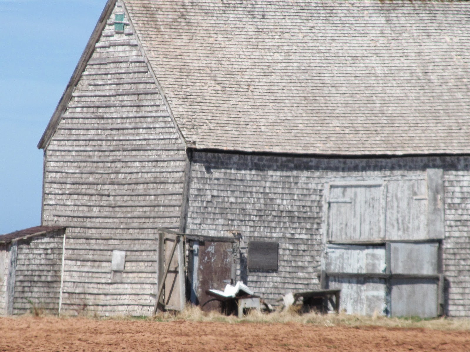
     Further up the road on the North Cape Coastal Drive (Rte. 14) I stopped in Nail Pond to take a photo of this abandoned homestead nicely situated with the Northumberland Strait in the background.  The farmland runs down to the shore - we Islanders call these farm fields, "shore fields".
     Every time I research a property on Prince Edward Island I take notice of the property identification number (PID) - today our PID's are six or seven digits.  Our family farm in Alma, settled in 1860, has a five digit PID - I always thought that was an old property number.  I was surprised to see the property number for this farmstead is a four digit number - this is an old property!  
     I was more interested in the old barn - possibly dating to mid-late 1800's.  The house I would guess to be in the 100 year old range.
      The barn is completely covered with cedar shingles - roof and walls.  The proportions indicate a very old barn. 
      Meachams 1880 Atlas of Prince Edward Island shows Prospere Gallant living here with 35-acres.
     Cumins 1928 Atlas of Prince Edward Island shows John DesRoches living here with 35 acres.  They list his wife as being Elizabeth with the following children:  Roderick, Gilbert, Delima, May, Nelson, Peter and Edwin.
     The current owners live nearby - they aren't Gallant or Desroches.

Wednesday, April 30, 2014

Old Barn, Huntley

     This old barn will soon be gone - like so many old barns in rural Prince Edward Island.  
     This farm belonged to Will Horne who likely built the barn sometime in the 1930's.  The farm was bought by Ross & Jean Brennan in the early 1970's - they lived here for near a decade.  The property has changed hands a few times over the years.  The barn has been used for storage for near 25 years.
     My father, Wilbert Jeffery, worked here as a young man in the 1940's and 50's - he recalls this barn always being here.
     Will Horne married Mary Gordon, daughter of John Owen and Grace (Riley) Gordon, of the Western Road in Alma.  
     Meacham's 1880 Atlas of Prince Edward Island show this farm belonging to a large section of land (240 acres) of the Estate of Rob't Gordon.  
     Cumin's 1928 Atlas of Prince Edward Island shows William Horne owning 75 acres here.
     Above: the barn north side of the barn which is located on the south side of the Cheese Factory Road in Huntley.  The Cheese Factory Road connects Huntley to Alma. 
      Above/Below:  The northeast corner of the barn.  The metal siding and roofing is being removed in preparation for demolition.

Tuesday, January 14, 2014

Doull-Clark "Rolling Bank Cottage", Wilmot Valley

     I've been noticing this old house for many years as I travel the Blue Shank Road between central and western P.E.I.   The house is set not far off Blue Shank Road on the MacMurdo Road (Route 120) in Wilmot Valley.  The house is situated on the east side of MacMurdo Road with the Wilmot River below/south of the house.
    Today I finally stopped to take a few photos with my smart phone - the real camera was at home.
     The house was built by George Doull about 1850.  George was a carriage maker - the 1861 Census taker notes that he had a shop near Rolling Bank Cottage and had made four carriages.  Later Doull moved to Summerside where he became known as a fine furniture builder.  Wm. Charles Clark (and Margaret Lefurgey) bought the house from the Doulls.  The Clarks had eleven children.   The following information cf.
     This house is in the "cross-gable" design which has a front gable who's eaves reach across from side-to-side of the front of the house to meet with the main house end gables.
     The Meachams's 1880 Atlas of Prince Edward Island shows this property belonging to Charles Clark with 100 acres.
     The Cumins 1928 Atlas of Prince Edward Island shows this property belonging to Fred Clark with 90 acres.  Married to Ethel Walker with eight children.
     Today the house remains in the Clark family.
Above: the Wilmot River to the left - to the right is the south yard of the house.

Thursday, November 21, 2013

Chelton Saltbox House

     This is the last posting from my tour around the Chelton and Fernwood area.  
     This very old house at 48 McCardle Road caught my eye!  It would date to the mid 1800's - seemingly a saltbox style house with a center dormer on the east front.  The kitchen wing off the west would likely have been added later.  Not many saltbox houses remain on the Island - today a few remain can be found in Charlottetown's old downtown. 
     The three photos below were taken from the Campbell Road, the next road up, paralell to the McCardle Road.  
     Sorry, the photos are a bit blurry!   That's the Confederation Bridge in the background.
     The following four photos were taken from McCardle Road.  Also, there's an old barn/shed (possibly an old house from the size of the windows) to the rear of the property.
     This house is For Sale through Century 21.  The old house has had many "not so sympathetic" updates including new windows and vinyl siding.  
     The real estate listing describes the house as  “Spacious century old farm with a million dollar view...great multi-family home...”   It also notes the house having 5 bedrooms in 2,500 sq.ft. on a 1-acre lot.  
     Here’s the link to Century 21  http://www.century21pei.com/details.php?id=13068085&c=1
     The following photos are from the real estate listing.
* * * * * * * * * * *
      The 1863 Lake Map (below cf. http://www.islandregister.com/lakem/lots/lot26.jpg) shows P. Callbeck at this location with Wm. Wright as a neighbour ( this is possibly P. Callbeck, president of Legislative Council in 1774, 1786, /  Philipps Callbeck, Attorney General 1770 cf. http://www.islandregister.com/meachamexerpts.html ).
 Below:  close-up look.
     According to Meachams 1880 Atlas of Prince Edward Island, this property belonged to Wm. Lowther with 39 acres and 23.5 acres across the road along with two other parcels of 25 and 78 acres, northward up the Chelton Road.  
     In Cumin’s 1928 Atlas of Prince Edward Island shows Fred Murphy owning this property.

Saturday, September 21, 2013

Weeks House, Fredericton

     I took the following photos of the old Weeks farmstead back in May of this year and now just posting them - it's still for sale.
     Stephen and Ann (Large) Weeks established this farm on the Malpeque Road (Rte.2) in Fredericton in 1830.  They first built a log hut down by the stream below the present house.  Within a few years they built a better house a bit up the hill.  Then another few years a bit larger house further more up the hill.  Then they build a 1850's central fireplace style, post and beam house which sat across the driveway from the present large house - it was still on the property and used as an outbuilding as late as the early 2000's. 
     Stephen and Ann's son "John Weeks" took over the farm from them.  He married Charlotte Howard.   Meecham's 1880 Atlas of Prince Edward Island shows John Weeks owning 125 acres on this farm.  
     John and Charlotte's son "Heber Weeks" took over the farm next.  He married Edith Brehaut.  Cumin's 1928 Atlas of Prince Edward Island shows Heber still owning the original farm of 125 acres.  The Atlas also notes that Heber and Edith with two children: Raymond and Boyd, later they had a sister Hazel.  Heber built a new 2-storey house similar to the present house around 1900, however, within a decade they lost it to fire - they moved across the driveway to the old central chimney house till this present house was built.
     The next to take over the farm was "Boyd Sheldon Weeks".  He married twice with not much luck and had no children.  Boyd died in early 2007.  
     The farm was sold to another branch /cousins of the Weeks Family - today they have it for sale. 
      I took the following three photos in the May 2007.  Since these photos a young couple bought the house and started to fix it up.